Gloucester County Projects
Site Purpose: Intersection Improvements
Developer: R.E. Pierson Construction Company
Engineer: Remington & Vernick Engineers
Monroe Township
Location: Glassboro Road (US 322) and Fries Mill Road (CR 655)
Description: Intersection Improvements to Glassboro Road (US 322) and Fries Mill Road (CR 655). The intersection will be widened for dedicated turn lanes for all directions. The project will include roadside shoulders, new traffic signals, sidewalk, ADA curbing and drainage upgrades.
Aerial Drone Progression Report
Job Site Aerial Photos - October 19, 2023
Aerial Photo Gallery: Mouse over any image to see download options. Click on any image to display the Slideshow mode.
Slideshow Mode: View photos at your own pace. Use the forward/backward arrows or the mouse wheel to move between the images. Hold Shift Key down and scroll the mouse wheel to zoom in and out of the image.
Activate auto slideshow mode by selecting the Start Slideshow icon in the upper left corner. In auto mode, each image will be displayed for 3 seconds.
Aerial 360 View
Various 360 Aerial Views of the Rt 322 & Fries Mill Road renovations project.
Click and swipe on the image to rotate the view. Use the arrows or dots to cycle through the different points of views. Go full screen by selecting the box in the upper right corner of the image.
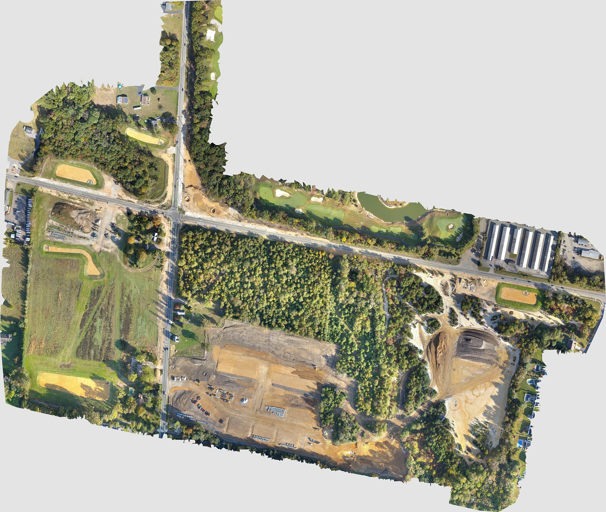
Construction Site Orthomosaic - October 19, 2023
The view below contains the orthomosaic taken at the job site on October 19, 2023. Fries Mill Road is shown running North & South. Route 322 is shown running East & West.

To view higher resolution Ortho, select file below to download to your workstation. Please note the file size is large. It is best to download and view from your laptop/workstation.
Disclaimer
Please note, Aerial View Advantage does not have a licensed land surveyor on staff to provide survey grade analysis. Aerial View Advantage can collect data and provide to your licensed surveyor for review and analysis. This is not exclusive to Aerial View Advantage. All drone data collection services cannot interpret data unless they have a surveyor on staff.
